
New Orleans, LA → Miami, FL
870 mi · 14h 34m (driving)
Current Risk
Medium Risk
Heavy rain near Miami
New Orleans
81°
28.9°
81°
27.9°
77°
26.8°
78°
Miami
75°
Trip Briefing
4 segments · 870 mi · 14h 35m
Weather
☀️ Clear sky
81°F, wind 4 mph
Rest Stops
21
Truck svc, Restrooms
Cameras
8 live
Clear driving conditions expected
Rest stops in this segment:
- ● TA
- ● Rest Area 🚻
- ● Slidell I-10 Rest Area & Visitor's Center 🚻
Weather May Slow Traffic
Active weather advisory — expect slower travel
Traffic Cameras
See recent road conditions along your route
Images are snapshots updated periodically by state DOTs. Timestamps shown in images indicate when each photo was captured.
Your Route
Via I-10 → I-10 East → ... → US-1 → SR-970
Cameras shown are along this computed route
Need a custom route?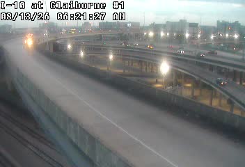
I-10 at US 90 Claiborne Overpass
LA ·
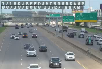
I-10 at Jefferson Davis DMS
LA ·

I-10 at Jefferson Davis Pkwy.
LA ·

I-10 at Orleans Ave
LA ·

I-10 at Claiborne
LA ·
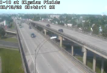
I-10 at Elysian Fields
LA ·

I-10/I-610 at Franklin Ave
LA ·

I10-MM 000.7EB-Agriculture Sta
FL · EB

I10-MM 028.3EB-Ward Basin Rd
FL · EB

I10-MM 095.9M SR-81
FL · EB

I10-MM 165.4EB-Flat Creek Rd
FL · EB
I-10 E of CR-257/W Jefferson Cty Line
FL · EB
Rest Stops Along Your Route
82 stops available
Swipe to see moreShowing 1-2 of 82

Get Weather Alerts for This Route
We'll notify you when conditions change before your trip. Never drive into a surprise storm again.
⚡ Recent Weather Events on This Route
Premium users received alerts for these conditions:
- 🌧️Sep 27: Heavy rain expected near 27.9° - consider afternoon departure
Don't miss the next alert →
Driving from New Orleans, LA to Miami, FL covers 870 miles in roughly 14h 34m of drive time, crossing state lines. We track 12 live traffic cameras, 82 rest areas and 3 active weather alerts along this corridor so you can plan around them. On a drive this length, weather can change dramatically between stops. Use the segment-by-segment forecast below to time your route.
7-Day Driving Outlook
Today
Sep 29
88° / 81°
No precip
Tomorrow
Sep 30
88° / 76°
No precip
Thu
Oct 1
88° / 78°
No precip
Fri
Oct 2
83° / 79°
No precip
Sat
Oct 3
80° / 76°
No precip
Sun
Oct 4
81° / 76°
No precip
Mon
Oct 5
81° / 77°
No precip
🗓️ Weekend Outlook
Saturday
Good to Go🌦️ Moderate rain showers at origin, 🌦️ Moderate rain showers at destination
Sunday
Use Caution🌧️ Heavy rain → 🌦️ Moderate rain showers. Use caution.
Plan This Route
Get hour-by-hour weather forecasts, real-time traffic, and find the optimal departure time.
🚗 Live traffic included
See if current slowdowns affect your drive time
Free • No sign-up required
Current Conditions
New Orleans, LA
81°F
Wind: 4 mph
Miami, FL
75°F
Wind: 4 mph
Weather data updated in real-time
Driving from New Orleans, LA to Miami, FL
The drive from New Orleans to Miami spans approximately 870 miles and takes just under 15 hours, making it a substantial but entirely manageable road trip that showcases the dramatic transformation of the American South. You'll primarily follow Interstate 10 eastbound out of New Orleans toward Baton Rouge, then transition to U.S. Highway 90 as it hugs the Louisiana and Mississippi coasts, offering glimpses of bayou landscapes and historic Gulf communities. After Mobile, Alabama, you'll merge onto Interstate 10 again through the Florida Panhandle before eventually connecting to Interstate 75 southbound, which becomes your main artery all the way down the spine of Florida to Miami. This routing avoids the more inland I-95 corridor and instead takes you through some of the Southeast's most characterful regions.
The landscape shifts dramatically as you progress eastward. Leaving New Orleans, you'll travel through Louisiana's wetlands and bayou country, where the terrain is remarkably flat and water is never far away. Once you cross into Mississippi and Alabama, the landscape gradually rises and becomes more forested, with the Appalachian foothills visible in the distance. As you enter Florida and head south on I-75, the terrain flattens again, and you'll notice the vegetation becoming increasingly subtropical—the pines give way to palmettos, and the air itself begins to feel different. You'll pass through or near significant cities including Baton Rouge, Mobile, Pensacola, Tallahassee, Ocala, and Tampa before reaching Miami, each offering opportunities for stops and rest breaks.
Driving this route requires understanding its distinct sections. The Louisiana and Mississippi coastal portions are quite rural, with long stretches between major towns, so fuel up strategically. The Florida Panhandle section through Tallahassee and beyond involves slightly rolling terrain but remains generally easy driving. The final four hours down I-75 through central Florida become increasingly congested as you approach the Miami metropolitan area, particularly in the last 50 miles. Plan to tackle the drive over two days if possible, breaking in the Tampa or Ocala area, which transforms an exhausting marathon into a more pleasant journey.
The optimal time for this drive is late fall through early spring, roughly October through April, when temperatures remain moderate and humidity is lower. Summer months bring intense heat and afternoon
The 870-mile drive from New Orleans, Louisiana to Miami, Florida takes approximately 14h 34m under normal conditions. Weather along this route can vary significantly, especially along coastal regions where fog and marine weather can impact visibility. Route Outlook helps you find the safest time to travel by showing you weather conditions at every point along your route, timed to when you'll actually be there.
Common Weather Hazards on This Route
- Severe thunderstorms and flash flooding (spring and summer)
- Hurricane and tropical storm impacts (June through November)
Seasonal Driving Considerations
Coastal weather on this route can shift quickly. Marine fog is common during morning hours, especially in spring and fall, reducing visibility to near zero. Hurricane season (June through November) can bring extended road closures and dangerous conditions. During fair weather, coastal routes offer scenic driving — but always verify conditions with live traffic cameras before heading out.
Best Time to Drive New Orleans to Miami
For long drives like this 870-mile journey, planning is essential. Consider breaking the trip into segments if weather looks challenging. The best approach is to check conditions for multiple departure times using Route Outlook's optimizer, which considers weather at each point when you'll actually be there.
Driving Strategy
Covering 870 miles from New Orleans to Miami is a full-day or multi-day drive that requires advance planning. Break the route into manageable segments, planning fuel and rest stops every 2-3 hours. Weather that looks fine at departure may deteriorate significantly at the midpoint. Consider booking overnight accommodation if the forecast shows deteriorating conditions in the latter half. Route Outlook's segment-level weather data helps you identify exactly where and when conditions will change.
Pro Tip
Use Route Outlook's departure optimizer to find the best time to leave. Our 4D trajectory engine considers weather at each point along your route at the exact time you'll be there — not just at your destination. It also integrates live data from traffic cameras, DOT 511 feeds, and road weather sensors.
Frequently Asked Questions
How long is the drive from New Orleans to Miami?
The drive is approximately 870 miles and takes about 14h 34m under normal traffic and weather conditions. Severe weather can add significant time to your trip.
What's the best day to drive this route?
Based on current forecasts, Saturday, Oct 3 looks ideal. Low chance of precipitation with manageable conditions
Is it safe to drive from New Orleans to Miami today?
Current conditions show medium risk along this route. Consider delaying your trip if possible. If you must travel, reduce speed significantly and be prepared for rapidly changing conditions.
Are there rest areas on the New Orleans to Miami route?
Yes, there are 82 rest areas along this route. Facilities include restrooms, parking, and in some cases picnic areas and vending machines. Rest stops are spaced throughout the drive, so you'll never be too far from a break.
Can I see live traffic cameras on this route?
Yes, Route Outlook shows 12 live traffic cameras along this route, sourced from state DOT feeds. You can check road visibility, traffic flow, and pavement conditions in real time before and during your drive.
What highways does this route use?
This route primarily uses I-10. Conditions can vary between highway segments, so check live camera feeds and road condition reports for each stretch before departing.
Are there any road closures on this route right now?
No significant incidents or road closures are currently reported along this route. Conditions can change quickly — this page updates automatically with the latest data from state DOT 511 systems.
Related Driving Guides
Drive Mode: Your Weather Intelligence Companion for Road Trips
Learn how Route Outlook's Drive Mode works alongside Google Maps and Waze to keep you informed about weather and road conditions while you drive.
🔗Share Your Road Trip Plans: How to Keep Family Informed and Safe
Learn how sharing your driving routes with family and friends can improve safety and provide peace of mind for everyone during your travels.
⏰Finding the Safest Time to Drive: A Data-Driven Approach
Learn how 4D trajectory analysis can help you find the optimal departure time to avoid dangerous weather and traffic.
Explore More Routes
More routes from New Orleans
More routes to Miami
Similar-distance drives
More routes starting in LA
Don't Drive Blind Into Weather
Route Outlook shows you conditions at every point along your route—at the exact time you'll be there.
Open Planner